Property Record
5962 Brainerd Rd, Chattanooga, TN 37421


NEARBY LISTINGS FOR SALE OR LEASE
Property Detail
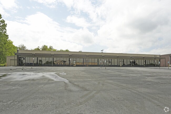
5962 Brainerd Rd
Chattanooga, TN-GA
Clifford Friar Farms
157L-D-024
LT 2 CLIFFORD FRIAR FARM PB33 PG95
Officebuilding
Hamilton
AE
Tennessee
47065C0364G
2
2024
1.60 AC
2024
Outlying Chattanooga
003400
Chattanooga
12,741 SF
DEMOGRAPHICS near 5962 Brainerd Rd
1 Mile
3 Mile
5 Mile
2024 Total Population
3,473
52,930
148,910
2029 Population
3,664
56,102
158,174
Pop Growth 2024-2029
+ 5.50%
+ 5.99%
+ 6.22%
Average Age
39
41
40
2024 Total Households
1,597
23,156
61,316
HH Growth 2024-2029
+ 5.57%
+ 6.11%
+ 6.32%
Median Household Inc
$33,083
$51,905
$51,845
Avg Household Size
2.10
2.20
2.30
2024 Avg HH Vehicles
2.00
2.00
2.00
Median Home Value
$141,230
$185,499
$190,486
Median Year Built
1969
1968
1972
Nearby Places
Map Layers
Map Styles
 Street
 Aerial
- Restaurants
- Banks
- Shops
- Fitness
- Groceries
PUBLIC TRANSPORTATION
AIRPORT
Lovell Field
DRIVE
WALK
Distance
Lovell Field
7 min
1.6 mi
SALE & LEASE HISTORY
LISTING DATE
SALE/LEASE

Sep 24, 2016
For Sale
Oct 25, 2017
For Sale
Apr 04, 2017
For Lease
Nearby Properties
Address
Land Use
TOTAL SIZE
Lot Size
Zoning
Address
Land Use
TOTAL SIZE
Lot Size
Zoning
832.10 AC
M1
Address
Land Use
TOTAL SIZE
Lot Size
Zoning
564,883 SF
27.46 AC
C2
Address
Land Use
TOTAL SIZE
Lot Size
Zoning
292,309 SF
45.28 AC
M1
Address
Land Use
TOTAL SIZE
Lot Size
Zoning
94,933 SF
23.87 AC
R4
Address
Land Use
TOTAL SIZE
Lot Size
Zoning
2,336 SF
21.34 AC
R3
Address
Land Use
TOTAL SIZE
Lot Size
Zoning
355,219 SF
27.72 AC
R3
Address
Land Use
TOTAL SIZE
Lot Size
Zoning
5,008 SF
17.97 AC
R1
Address
Land Use
TOTAL SIZE
Lot Size
Zoning
1,960 SF
19.50 AC
R2
Address
Land Use
TOTAL SIZE
Lot Size
Zoning
110,710 SF
6.69 AC
M1
Address
Land Use
TOTAL SIZE
Lot Size
Zoning
138,790 SF
36.30 AC
R3
Address
Land Use
TOTAL SIZE
Lot Size
Zoning
790,207 SF
53.84 AC
C2
Address
Land Use
TOTAL SIZE
Lot Size
Zoning
266,271 SF
26.27 AC
R2
Address
Land Use
TOTAL SIZE
Lot Size
Zoning
1,200 SF
14.10 AC
Address
Land Use
TOTAL SIZE
Lot Size
Zoning
209,168 SF
23.28 AC
C2
Address
Land Use
TOTAL SIZE
Lot Size
Zoning
85,068 SF
9.57 AC
Address
Land Use
TOTAL SIZE
Lot Size
Zoning
121,263 SF
13.51 AC
C4
Address
Land Use
TOTAL SIZE
Lot Size
Zoning
67,735 SF
17.32 AC
M1
Address
Land Use
TOTAL SIZE
Lot Size
Zoning
66 AC
R4
Address
Land Use
TOTAL SIZE
Lot Size
Zoning
249,066 SF
19.80 AC
Address
Land Use
TOTAL SIZE
Lot Size
Zoning
90,493 SF
1.88 AC
Address
Land Use
TOTAL SIZE
Lot Size
Zoning
147,332 SF
9.44 AC
R4
Address
Land Use
TOTAL SIZE
Lot Size
Zoning
4,800 SF
9.60 AC
R3
Address
Land Use
TOTAL SIZE
Lot Size
Zoning
66,027 SF
2.84 AC
C2
Address
Land Use
TOTAL SIZE
Lot Size
Zoning
88,285 SF
7 AC
R3
Address
Land Use
TOTAL SIZE
Lot Size
Zoning
925 SF
10.05 AC
R1
Address
Land Use
TOTAL SIZE
Lot Size
Zoning
2,048 SF
7.67 AC
Address
Land Use
TOTAL SIZE
Lot Size
Zoning
66,390 SF
4.37 AC
C2
Address
Land Use
TOTAL SIZE
Lot Size
Zoning
215,385 SF
14.10 AC
UR
Address
Land Use
TOTAL SIZE
Lot Size
Zoning
78,423 SF
11.93 AC
C2
Address
Land Use
TOTAL SIZE
Lot Size
Zoning
58,551 SF
5.30 AC
R4
The World's #1 Commercial Real Estate Marketplace
Connect with us
© 2025 CoStar Group
The information above has been obtained from sources believed reliable. While we do not doubt its accuracy we have not verified it and make no guarantee, warranty or representation about it. It is your responsibility to independently confirm its accuracy and completeness. Any projections, opinions, assumptions, or estimates used are for example only and do not represent the current or future performance of the property. The value of this transaction to you depends on tax and other factors which should be evaluated by your tax, financial, and legal advisors. You and your advisors should conduct a careful, independent investigation of the property to determine to your satisfaction the suitability of the property for your needs.